Precision Aerial Data Acquisition and Media Services
Strategic Aerial Perspective for Texas
For any aerial survey requirement in Texas, Houston Helicopter Charters delivers an extensive array of advanced solutions, capitalizing on the unique low-altitude flight and precision hovering capabilities of helicopters. This includes highly detailed magnetometer and electromagnetic surveys, LiDAR data acquisition, comprehensive GIS mapping, and more. Beyond data collection, we specialize in advanced aerial filming and photography services, providing access to state-of-the-art cinematography technology, including options for door-off operations for unencumbered handheld shooting. When comprehensive aerial intelligence and visual documentation are paramount across Houston and the broader Texas landscape, our options are unparalleled.
Aerial
Surveys
LiDAR, GIS Maps, FLIR, HD Video & More
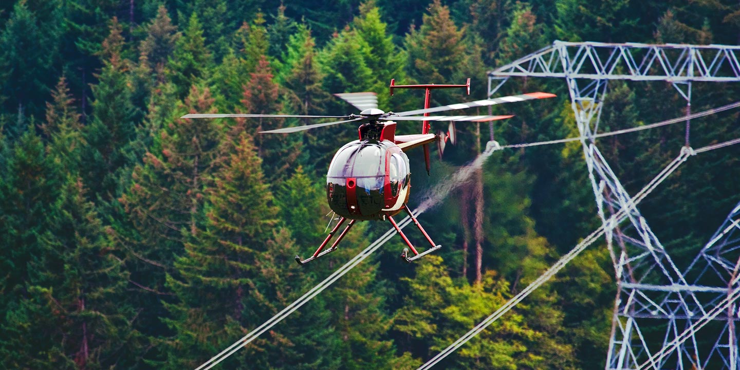
For critical infrastructure oversight, Houston Helicopter Charters provides the optimal rotary-wing assets and specialized equipment required for precision execution. From detailed pipeline integrity surveys and comprehensive right-of-way inspections to vigilant transmission line patrols across Texas, our solutions are engineered for accuracy and efficiency, ensuring your projects meet stringent operational standards.
High Tech Results
The Top Pilots in Texas, Today's Technology... Maximum Results.
Call 1-866-826-4826 Now!
Houston Helicopter Charters provides the tools needed to complete your land surveys, utilizing the right equipment to provide the aerial photos that are often needed.
An effective aerial survey provides unparalleled clarity for right-of-way (ROW) and site inspections, precise topographical data gathering, and high-definition imagery crucial for commercial ventures throughout Texas. Helicopter surveys offer the most advantageous perspective for examining vast terrains, meticulously inspecting pipelines for anomalies, detecting issues within critical transmission lines, or capturing detailed video and photographic documentation of commercial properties. Houston Helicopter Charters excels at engineering bespoke photographic and remote sensing operations, custom-tailored to maximize both technical efficacy and fiscal efficiency for superior project outcomes in the Houston metropolitan area and beyond.
The inherent operational characteristics of a helicopter make it the quintessential platform for aerial surveying. Unlike fixed-wing aircraft, which are often restricted by FAA minimum altitude regulations typically requiring 1,000 feet above obstacles, helicopters possess the unique ability to fly significantly lower and maintain precise, sustained loitering. This unparalleled maneuverability enables close-quarter inspection of challenging or hazardous zones, providing engineers and project managers in Texas an invaluable vantage point otherwise unattainable for critical infrastructure assessments.
There is no better way to conduct your visual survey, animal population counts, soil drainage analysis, ROW inspections, pipeline and transmission line inspections, and geographical surveys.

LiDAR Imaging
Light Detection and Ranging, or LiDAR, is a remote sensing method used to examine and measure Texas topography as well as objects, like vegetation, upon it.

Infrared Imaging
Thermographic IR cameras are used to detect radiation in the long-infrared range of the electromagnetic spectrum and produce images of that radiation, called thermograms.
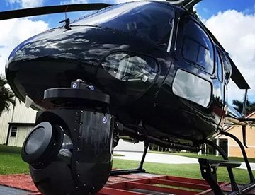
HD Video Gimbal Capture
Modern HD and 4K cameras can be mounted to helicopters, using the proper STCs, with a gimbal to stabilize photos & videos for detailed results.
Specialized Aerial Cinematography for Texas Productions
For expert camera work in the Houston Sky
Get a Fast, free QuoteHouston Aerial Cinematography
Houston Helicopter Charters provides comprehensive access to all prerequisites for professional-grade aerial cinematography across Texas. We facilitate advanced rotary-wing platforms equipped with the latest gyro-stabilized camera mounts, including industry-standard systems such as Tyler Mounts, Wesscam, Cineflex, Pictorvision, and SpaceCam. These platforms support a spectrum of specialized cameras, from Cineflex HD and RED Epic to Arri Alexa, alongside innovative 3D and experimental camera configurations. We expertly support all facets of your production goals, whether executing intricate air-to-air or demanding ground-to-air sequences. Our operational support teams collaborate meticulously with aerial Directors of Photography and directors to achieve precise visual outcomes. Specializing in helicopter provisions for both still and motion photography, Houston Helicopter Charters is adept at facilitating nearly every media-related operation throughout Texas, encompassing feature films, television productions, documentaries, promotional videos, commercials, aerial props, and critical coverage of historical or major sporting events across the Houston region and beyond.
Call Us Today at 1-866-826-4826 for a Free Quote
Contact Us
Aerial Photos
Hand-held or Mounted OpTions in Houston
We will help you get the right equipment for your aerial photography project! Call 1-866-826-4826 today to get a fast, free quote.
The Most Options for Photography
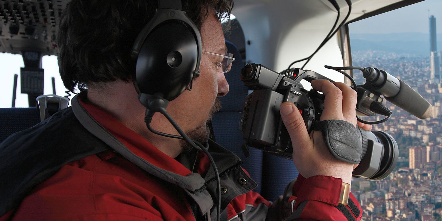
The expansive and often spectacular vistas of Texas are best appreciated and documented from an aerial perspective. Houston Helicopter Charters specializes in curating bespoke aerial photography charters engineered to surpass your creative expectations, enabling the precise capture of your conceptual vision. We offer cost-effective opportunities for acquiring high-quality aerial imagery across the state, from the Houston coastline to the vast expanses of West Texas. Many rotary-wing aircraft can be configured with doors removed for unencumbered handheld projects; for enhanced stability and precision, advanced gyro-stabilized camera platform options are available upon consultation.
Superior Service
Every one of our customers gets a dedicated helicopter expert to assist with flight plans, tech loadouts, production logistics, project schedules, and other demands.
Over 500 Aircraft
Our network of direct air partners extends well beyond Houston, Texas. This allows us to offer a wide range of solutions for even the most sophisticated projects.
The Best Equipment
From high-tech sensors like LiDAR, FLIR, and GIS to HD cameras and movie production gimbals, we're here to make your job as easy as possible.